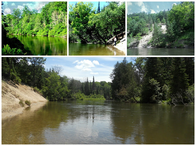
The Platte which begins in Grand Traverse County, into Manistee through Benzie County and meets Lake Michigan near Frankfort, is too docile for my adventure partner. Granted, I was not enthusiastic about having to paddle across Crystal Lake. That leaves us with the Manistee. The Manistee begins in Antrim County and runs 190 miles through Kalkaska, a tiny bit of Missaukee, Grand Traverse & Wexford counties, and Manistee county where it comes out in the city of Manistee. We traveled 18 of those 190 miles on Saturday.
 |
| still water at the landing |
The scenery on the Manistee is astounding. I had decided not to look up the river's particular's before hand because I wanted to be surprised. And the Summer of Sherry is also about getting back to trusting people. With my anxiety issues that is hard to wrap my head around. Determined to let the few friends that I have lead once in awhile instead of being in control, I decided to let it roll. And I am glad that I did. I had no idea that we would find ourselves drifting through passages lined with towering sand dunes. There were a few places it felt like being in an Indiana Jones movie. It was amazing! I can not say that enough. UH-MAZE-ING!!!!
A few small rivers and creeks empty into the Manistee along the way. In the mouth of one of the larger ones I stopped to look at rocks. I stopped really to take a break from my anxiety. I have to be honest, trusting some one else to steer is harder than I imagined. I was so paranoid about tipping that any disturbance in the canoe shattered my nerves. So my squirmy adventurer's bug swatting wracked my nerves. Additionaly, that hamstring became painful. The seat cut right at the tear in the butt cheek and the shallow seats didn't help the shortened hammie at all. The best benefit of getting out in the creek mouth was a deal of rock hunting. That river was quite cold though so I couldn't stay in long. And I didn't need to. I found a few great pieces of olivine.
Why doesn't it all wash down the river? How do the sands stay put? Wikipedia says that glaciers cut these rivers. As we all know that water always wins, I have to wonder how it is that the banks stay. Do the trees and grasses keep them still? There were several places where the base of the sands were clay and water ran like falls from only a foot above water level. How do they survive the currents?
We had a lot of company on the trip; cedar wax wings, ducks, jays, some kind of king fisher, cliff swallows, and eagle and even a bat. Yep, little brown bat obviously didn't know what was about as it was about 1 in the afternoon when he flew overhead. There weren't any land creatures visible even though we heard them crashing in the underbrush. Maybe next time we will see more. And maybe next time I will be comfortable enough to take my own camera.
One of the Manistee's features is in its assumed Ojibwe name of "ministigweyaa". According to Wikipedia the name means river with islands at its mouth. I don't know if there are island in the city of Manistee where the river empties into the big lake. But I do know that there are islands throughout the river. We were nearly stymied by two that we came upon. The smaller one seemed most likely a beaver construction made from much of the fallen trees along the way. The second was definitely an island. The right hand channel was completely blocked by debris. It proved quite an interesting part of the adventure. A good many trees have fallen in the last year after a few storms went through. That does make for interesting traveling.
All in all it was a good trip. I am looking forward to going again but being a bit more relaxed the next time out.


No comments:
Post a Comment