

The Tunnel of Trees' official designation is Michigan Highway 119, or M119. It snakes along the Lake Michigan coastline from the city of Petosky around Little Traverse Bay and through the quaint and bustling village of Harbor Springs to Cross Village. This was the second leg of our Mighty Mac trip. As we were on a mission we did not spend time in either Petosky or Harbor Springs. Petosky was a post two Summers ago and Harbor no longer has my favorite coffee shop so we did not stop. Harbor is a better Fall or Early Spring trip anyway. Too much traffic on this stop to oggle things. So we cruised through downtown to get to our real destination... the Tunnel.
 |
| Left bar: M119 literally snakes along the coast, taking this section at high speed is ludacris, Top row: the flock, cement plant in the distance, the barns of the sheep farm, Middle left and right: a variety of canopy density, Top Right:imitating the tropics, bottom: Good Hart General Store, Good Hart Post Office and another S-curve. |
You can see from the photo collage that it is aptly, if somewhat unimaginatively, named. Over twenty miles of woodlands with intertwined canopy along twisting roads beckons the daytripper. When you pass the country club it won't be long before you come upon one of the most bucolic scenes that will take you breath away. None of us expected to find an operational sheep farm. This farm's rolling pastures sits atop an upper cliff dotted with deciduous and coniferous groves overlooking Little Traverse Bay. In the far distance, through the early afternoon haze the Charlevoix cement factory sits like a strange lighthouse.

As we drove through here I was lost in thought as to how similar this forest is to the pictures I have seen of the German forests. Though I doubt that these trees have regrown sufficiently to mimic the giants of the German forests which inspire tales of dread and caution or could be the muses behind Tolkein's Ents. Groot maybe, but not the Ents. I do imagine that when my immigrant ancestors came they thought of their homes in the Schwartzwald, Grunewald, Thüringer Wald and the Odenwald of lore. A more apt name for this forested area here would be Gleichenwald: similar to the German forest. But then we would have to change a lot of signs and maps.
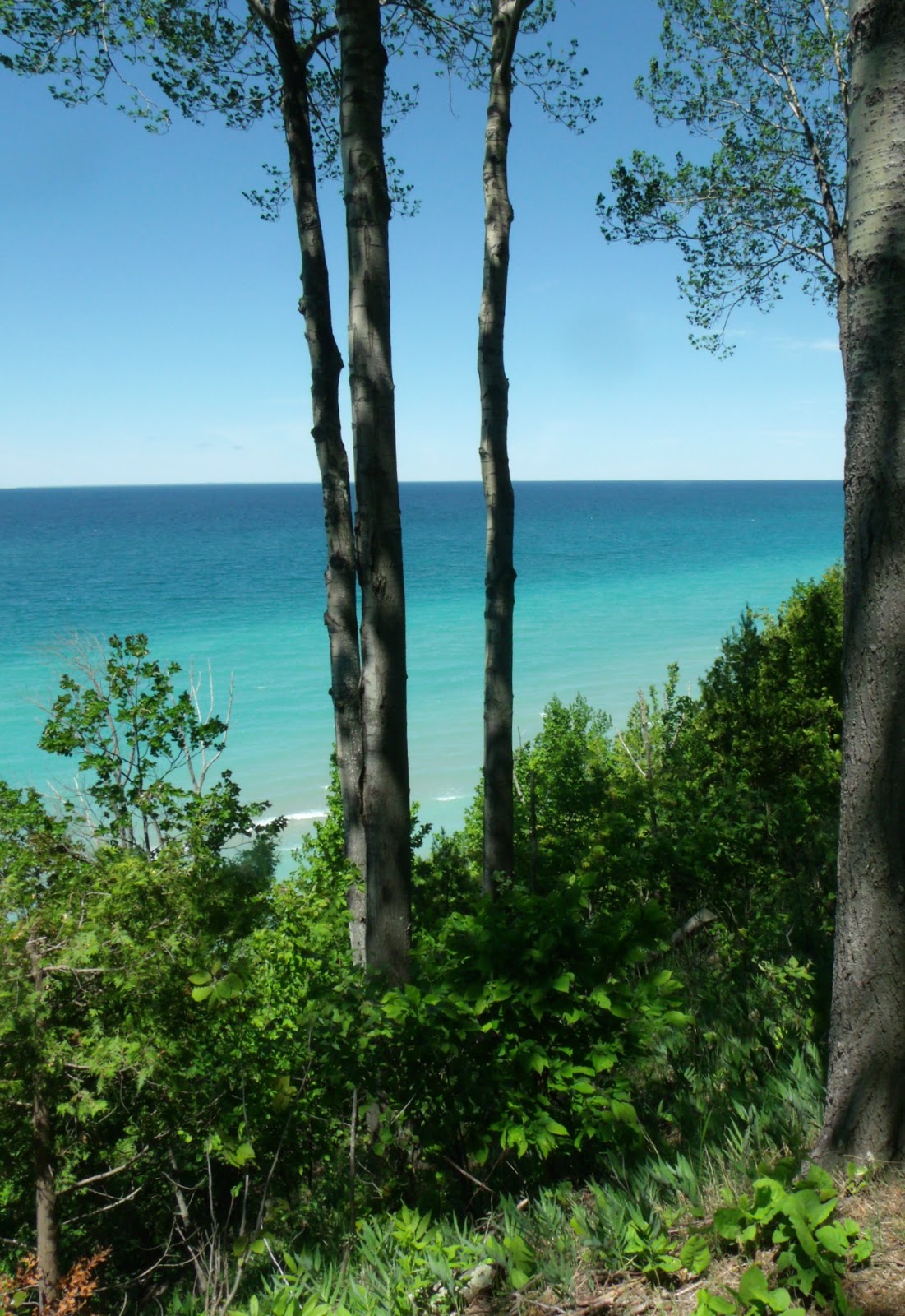
The Tunnel of Trees Heritage Trail, as it is formally called, follows the Lake Michigan shoreline closely. It isn't all wonders and imagination however. A sharp bend at Terpenning Road, known colloquially as The Devil's Elbow, is a treacherous curve that begins M119's close association with the coast line. This is not at all a road to drive at great speeds. Doing so may cause you to have a closer association with a hulking oak than you would like. The road sits atop the edge of the bluffs overlooking the big lake some 100-280 feet below the road. While it is impossible to see Lake Michigan for much of the 20 miles, there is a stretch after the Elbow beyond imagining.
It is somewhere along this passage that my housemate supposed actor Viggo Mortenson spent a Summer taking pictures and restoring an old cottage. She has lots of sidebar information in her head about stuff like that. And this was a really good trip for having conversations about nothing that were also not about crappy somethings and sad somethings that we can not change. Even in a car the natural beauty of our countryside and distant wilds has a calming effect. The mind wanders around the things we are curious about and not so much the things that we worry about. It could be the deep and lush greens of the canopy and the ground vegetation or it could be the vibrant jeweled blues of the water that calms. Which ever it is, whatever the combination of influences is, we need it. Nature heals the senses which I believe can calm a weary mind. Even in a car, whizzing along at 40 miles an hour.

Fewer homes sit in the dense forest. Fewer mailboxes mar pictures. And the conversation flows along meandering tangents until animals cross our paths. While it was the wrong time of day to see deer, there were a good many birds playing chicken with the car. The dappled light is soothing enough to make for some sleepy backseat passengers.
The road continues on like this until you get to the sleepy little town of Good Hart, the half way point on this long and winding road. Good Hart is a small place consisting of a General Store and Post Office maintained in picture postcard perfection. It is a great place for a potty break and to grab a bite to eat if you haven't packed a lunch like we did. The General Store stocks it's own specialty foods on the shelf as well as the expected standbys and has a deli. While we did not partake of the deli offerings, the homemade cookies near the register made mouths water. We were back on the trail once we refreshed ourselves.
The stretch between Good Hart and Cross Village begins to diversify with some sandy dunes breaking into the forest. The road becomes much more difficult to traverse as potholes and crumbling shoulders make for interesting conditions. M119 does not have a center yellow line down its middle as other state roads do and the fog line, the white line on the side, is worn. There is very little reason to travel this road at night and I wouldn't suggest trying. Even though it is a perfect Dark Sky site, the canopy is so thick over much of the road that you wouldn't really be able to see stars. This stretch also reminds me of the Pierce Stocking Drive in the Sleeping Bear Dunes National Forest on Leelanau Peninsula. The coast bluffs and the winds that rise from it probably have a lot to do with that as it makes difficult living conditions for all but the most hardy of species.

Sometime we will go again to sample the food here. People drive hundreds of miles to eat at the Legs Inn and I would like to taste what I am missing.
The Tunnel of Trees ends here in Cross Village. You have the option of going east to join US 31 and get back to civilization or continuing north. We opted for the northern route, erroneously thinking that we might get to the bridge along the entire tip of the mit*.Somewhere north of Cross Village the Wilderness State Park's 10,000+ acres is in the way. You have to veer east to the tiny one building town of Bliss to continue northward. Along the way there is more rolling farm land, some wetlands, a few more dunes, and some picturesque farms. Emmet county has very little flat surface to it. The whole thing is like a rollercoaster. No wonder my cousins enjoyed it so much.
We did get a bit turned around and were helped by a friendly FedEx driver. But once we were on our way it was smooth going into Mackinaw City.

*Tip of the Mit is the local vernacular for the region of Northern Lower Michigan encompassing Antrim, Otsego, Monmorency, Alpena, Emmet, Cheboygan and Presque Isle counties. They are the northern most counties of northern lower Michigan which is notable for its mitten shape.
No comments:
Post a Comment