Total Pageviews

Showing posts with label galavanting. Show all posts

Friday, July 22, 2016

Tallships Return to the Great Lakes

It started when I was little. My first memory of anything outside of our home is being on the dock at the marina. Mom and Dad took us to the zoo. It was just me and my sister so I had to have been about 3 years old. When we were done at the zoo we went down to the small little marina and looked at the boats. I was fascinated. For some reason, paper pirate hats had become a thing for Uncle Rich to give us when ever he came over. I guess he got them from Long John Silvers.
Then when I was about 12 a replica of Columbus' ships came to town. We got to climb all through the thing... as much as we could with all the "behave" admonishments. The Santa Maria was impressive, as was the Nina when it came nearly a decade later during an incarnation of the Tallship Festival. We saw HMS Bounty (O.B.M) when it came. And when any tallship came to dock we went. My sister was a galley hand on the Manitou, a ship formerly based in Northport which now does tours for the Traverse Tallship Company

And then mom went overboard. Everything became about the boats. She obsessed to the point where I didn't want to look at a ship for a long time, never mind get on one again. The Tallship festival went on without me. 
al
Last year, for whatever reason, I started thinking about tall ships again. DurinTs in the children's encyclopedia; a story of sea dragons, Indian Prince stuck on a raft, Old Man & the Sea, and a the story of privateer made mayor John Lafitte's cunning in defending New Orleans from pirates. The more swashbuckling the tale the more intrigued I became. Being a 10 year old girl and not a 10 year old boy, this was something of a shock to a lot of people. But Uncle Rich, as I said, indulged. And for a time so did my parents and grandparents. eventually my interests would swing to horses. Whenever we read anything for school pertaining to the sea my heart felt a special thrill. I loved the tallships in the security of the deepest part of my heart. 

Since this is the Summer of Sherry, and I am not saying no to the things that I love anymore, today was my Tallship Day. I've been so busy working for the last 10 Summers I didn't even noticed when we stopped having official tallship festivals. But it does explain the weird looks I'd get from front desk when I sighed my desires to go and not be stuck at work. Anyway... A couple of weeks ago news made it round facebook that there was a Great Lakes leg of the 2016 Tallships Challenge. It made a splash because Vikings. 

For the first time EVER a real Viking longboat has entered the Tallships Challenge. Draken Harald Harfagre, hailing from Norway, was schedule to sail the Great Lakes. You can well imagine the delight of the Norwegian-Americans in the region. Unfortunately, US Bureaucratic Red Tape nearly stopped it dead in the water at the St. Lawrence. Much complaining and some emergency fundraising let her underway. She has now rounded the tip of Michigan's mit at the Straits of Mackinac headed toward Beaver Island. None of the ships are scheduled to stop in Traverse City. Not officially anyway. The longboat isn't scheduled for any Michigan stops. Neither was the galeon Andalucia. But the minute that she was announced to stop, I got my but ready to go down and see her in. 

like a scene fresh outta Goonies
el Galeon Andalucia is a Spanish vessel out of Seville, Spain. The goal of the tallship festivals is to present history in a hands on setting. Spain, uses the Andalucia to teach topics from Old World sailing techniques to Spanish naval history. Galleons were shipping vessels that were pressed into exploratory service as circumnavigating the globe became a competition between European Kings. They represent  one of 10 types of vessels that comprised Phillip II doomed armada in 1588. Galleons are famous and most recognizable for being the ship of choice for self-respecting pirates in the Caribbean. Indeed, the little boy in front of me could barely contain his excitement at the thought of their being pirates aboard. That is until he remembered that his mom's phone could catch Pokemon. 

The official website does not list us as a stop. Apparently stops are being added along the way as cities issue invites and make docking a possibility. The announcement came on Wednesday. A storm system came through the region forcing the ships to stay on the Huron side. I didn't know that until I got downtown this morning and didn't see a ship. It was supposed to have been in Thursday night. It finally rolled in around 10:45. And the waiting and watching from Open Space was... entertaining?

I met a ship hunter down there and we chatted for a while. She told me that the Viking longboat was coming in to Frankfort Harbor for tours on Saturday and that today she was stalking the Galleon. She followed it in from Suttons Bay. We watched as several sailboats went out into the west arm of Grand Traverse Bay to meet it. It was just a tiny blip on the horizon, hard to make out between the haze and the the furled sails. As it came passed Power Island it made quite am impression. Following it into the harbor was both thrilling and terrifying as several boaters moored in the marina made some poor choices. One boater left his slip as the galleon rounded the break wall and was trying to enter the narrow passage to its mooring location. The Sheriff's department has to yell at him to go back to his slip as a chorus of "Moron" & "Lunatic" came from the elderly crowd of sideline captains around me. 

The docking process was amazing to watch as she turned and backed in to her spot. It was  truly one of the most majestic things that I have seen in a very long time. Andalucia will be here until Tuesday. I am employing all of my resources to make sure the Summer of Sherry includes a Viking longboat. And when she leaves Tuesday, my goal is to have video of her underway. 

I got some great shots while I was down there. 
this crewman was going about his business during the docking procedure. when he
noticed the camera he did stop and hold still. i didn't realize that is was quite on purpose
until i saw the photos enlarged & saw he made direct eye contact.
How cool is that? 


It was nearly high noon as she backed into
her slip. The haze of the day made this shot
possible.


Pulling up to the pier. Iconic Traverse City
landmark, theState Bank building
in the background


Pretty sure this was an unplanned stop. The parks department didn't
have a chance to cancel the sprinkles for the growing crowd. Though,
I must say, on this hot day it was a relief. 

Wednesday, July 6, 2016

Destination: Mighty Mac part four

Otherwise known as Hitchcock's The Birds Live Action.

the flock comes ashore

After tooling around downtown and Mackinac Crossings, it was time to do what I came north to do: Photograph the Bridge. Now due to the earth's curvature and sundry aspects of physics, it is not necessarily true that the closer you get to the bridge the bigger it is. The bigger it is the better it fits in the shot because details. I know this because we thought that driving the waterfront toward the bridge would let me get those gorgeous up close shots I see everyone else get. My thought was that if the bridge can loom so big and close over the tree tops when we are three miles away that being on the shore would make it bigger. In theory, art theory that is, this is true. In reality it is not.

Mackinac City's shoreline is dotted with public parks tucked between private homes. By my estimation they plop a park after every third of fourth house. The first park we stopped at was in poor relation to the bridge. It looked twenty miles away. With the haze of the afternoon fog it was hard to get details from so far away. So we hopped from one park to the next until we found one that would let me get the shots that I wanted. And that was Alexander Henry Park.

Alexander Henry, American born, friendly with many types of people from the Ojibwe of Michigan to the wealthy industrialists of the time, established secure trade with the French Canadians in the Great Lakes endeavors at Fort Michilimackinac after having supplied the British during the French & Indian War. Despite previous alliance with the British against native tribes, he became a part of the local culture when Wawatam adopted him as a brother. A series of misadventures among the less forgiving Ojibwe, which required Wawatam's intercession, carried him from one end of Michigan's Lower peninsula to the other along the Huron shoreline. In the end he returned to Fort Michilimackinac before setting off for the Lake Superior and Sasketchawan territories to challenge trade routes of the Hudson Bay Company. Following his trading and mapping forrays into the Northwest Terrtories, he travelled to England to offer proposals to the very company which he had challenged in the wilds of North America. From Britain to France in the court of Marie-Antoinette where he met with his first immutable failure to win favor and back to the American North he set out to develop trade with China and seek an overland route to the Pacific.

The overland endeavor never reached fruition under Henry. However, he did manage to engage JJ Astor in the northwest trade. Together with an association of other traders the North West Company did manage to establish trade with China. So encouraged by this success, Henry then set his sites on the American Interior, speculating in land deals with the Indian tribes the Ohio region. The deal along the Cuyahoga fell through when the Indians refused to acknowledge land deeds held by Henry's company. He settled in Montreal, engaging in militia and societal concerns, until his death in 1824. During this time he had written his memoirs which are heralded as the most comprehensive and accurate account of indigenous life in the region.

Alexander Henry is memorialized in Alexander Henry Park with a bronze likeness at the park's handicap accessible entrance. Henry was one of those affable people who found friendship and forgiveness easy to come by as the fortunes he amassed for himself and his partners in the fur trade with notably few exceptions. Fort Michilimackinac's success as a trading post, establishing a local community at the Straits of Mackinaw, undoubtedly belongs to Henry's personality and tenacity. The park is located just down the shore from Colonial Michilimackinac at the tip of lower Michigan at the bridge approach. This location provides one of the best shooting locations.

And one of the most populated. As I made my way to shore I noticed the was quite a large flock of Canadian Geese in the water. Assuming they were content to stay in the water at a safe distance I happily busied myself with photography. Seagulls rode the thermals, catching air  the way that pro surfers catch waves in an aerial dance that enthralls. Their graceful aeronautics hypnotize one into forgetting for a time that they are little more than flying garbage trucks, aggressive flying garbage trucks. Then they land and all of the magic and allure of flight is gone. But for a time one suspends prejudice for pure joy.


I like to have living beings in my photos. The action is a more dynamic image than static landscapes, living beings in pictures make it easier to engage the image as yourself rather than remaining a passive bystander. Seagulls, ubiquitous as they are, can not avoid the lens. And of course the geese can't help but take their place in the spot light. As I busily shot pictures after picture, the gaggle came ashore. As I had noted only about 16 birds and just a few wandered into view, I did not worry at all. 16 geese on a feeding mission in the surf are hardly a threat despite their ferocious and intrepid reputation. So I kept shooting. These were good shots with a lot of action. But still not THEE Mighty Mac shot I was looking for.


This is closer. It reminds me of so many Golden Gate shots out of San Francisco tourism brochures. Waves and gulls make a dynamic shot and it is well balanced. These northern gulls are more cooperative that the ones down home. I think the ones down home are more interested in sticking close to land where feeding is easier. At the bridge there are few fast food restaurants at which to dumpster dive. Of course I could be anthropomorphizing.

As usual, it took me a few tries to get the panorama that I was looking for.


This at least has the cove to anchor the shot on the left so that the bridge doesn't look like it comes out of no where. I just had hoped for more bridge detail. You can see here what I mean about curvature and physics and junk. We are not that far from the bridge but it is so much farther away in perception than the uprights were coming up I-75.

I probably spent a half an hour taking pictures. When sunset reduced my visibility and I turned to leave I froze in my tracks. Those 16 geese that I saw had turned into 30. And they all came ashore. A few of the protective males snaked their heads in my direction so I avoided getting closer or getting in their faces while they were on the shore. But when I turned to go back up the sidewalk, my way was blocked by a dozen of the adult geese. I didn't get a picture of this sight because I was terrified to move. The dozen adults had surrounded me on three sides and stood less than 10 feet from me. While that is disconcerting enough given their aforementioned reputation, those who surrounded me stood frozen in an identical stance... left foot firmly planted, weight thrown forward, necks twisted toward me and the right foot raised. They were ninjas in a crane position. And I am no Karate Kid.

I might have peed a little. I did back up four steps while they remained frozen. Slowly, I capped my lens, and stepped sideways up the small dune through a swarm of black flies and through the grass toward the maritime detritus posing as park sculpture. Once I hit the shade and assured myself that they did not follow me, I beat feet for the car. The only thing more terrifying than a dozen ninja geese posed to strike would be a knot of vipers randomly associated in the middle of  our driveway at home.

As I lived to tell this tale with all of my pieces and parts intact there seems little that should have worried me. However, I did make the mistake of watching Hitchcock's the Birds. And as Canadian Geese are the only thing viscous about Canada, to err on the side of caution is the divine rite of those with Vulcan sensibilities. Thus... we require less rescuing than our very human friends.

The trip home was rather uneventful even with the car tossing winds. Those winds had kept us from crossing the bridge so we will make this trip again. I think we will go closer to the fall to get the colors. And the next trip will have waterfalls. And maybe allow me to meet up with my U.P friends to add to the adventure. Of course if it rains that means out adventures will be limited to a Starbucks or local coffee shop for a day.

Day Trip: Manistee River

So one of my friends decided that the Holiday weekend, which coincides with the start of the National Cherry Festival, would be perfect for a canoe trip. Being local born and bred and considerably less enthusiastic for festivals than we once were in our youth, getting out of town is preferred. So we set our sites on one of the rivers outside of town. The Boardman, which empties into Boardman Lake in the middle of town, is a bit too close to all of the activities surrounding Cherry Festival.

The Platte which begins in Grand Traverse County, into Manistee through Benzie County and meets Lake Michigan near Frankfort, is too docile for my adventure partner. Granted, I was not enthusiastic about having to paddle across Crystal Lake. That leaves us with the Manistee. The Manistee begins in Antrim County and runs 190 miles through Kalkaska, a tiny bit of Missaukee, Grand Traverse & Wexford counties, and Manistee county where it comes out in the city of Manistee. We traveled 18 of those 190 miles on Saturday.

still water at the landing
We rented from Chippewa Landing. Our guide drove us up to Rainbow Jim Bridge to "put in". I didn't get his name, and for that I am sorry because he was fun to talk to. He kept everyone talking which was quite entertaining and informative. The bridge where we put in is named for the first river guide on the Manistee, Jim Coster. Rainbow Jim got his nickname from the type of fish he was most adept at catching, Rainbow Trout. The brochure lists this as a 5 hour trip. Our guide promised that we would have the river mostly to ourselves as we were out early. We did the trip in 4 as we did have a few groups to go around.

The scenery on the Manistee is astounding. I had decided not to look up the river's particular's before hand because I wanted to be surprised. And the Summer of Sherry is also about getting back to trusting people. With my anxiety issues that is hard to wrap my head around. Determined to let the few friends that I have lead once in awhile instead of being in control, I decided to let it roll. And I am glad that I did. I had no idea that we would find ourselves drifting through passages lined with towering sand dunes. There were a few places it felt like being in an Indiana Jones movie. It was amazing! I can not say that enough. UH-MAZE-ING!!!!

A few small rivers and creeks empty into the Manistee along the way. In the mouth of one of the larger ones I stopped to look at rocks. I stopped really to take a break from my anxiety. I have to be honest, trusting some one else to steer is harder than I imagined. I was so paranoid about tipping that any disturbance in the canoe shattered my nerves. So my squirmy adventurer's bug swatting wracked my nerves. Additionaly, that hamstring became painful. The seat cut right at the tear in the butt cheek and the shallow seats didn't help the shortened hammie at all. The best benefit of getting out in the creek mouth was a deal of rock hunting. That river was quite cold though so I couldn't stay in long. And I didn't need to. I found a few great pieces of olivine.

top right, a shallow dune on a bend, middle, me looking for rocks in a clay bed, left, glassy bend in the river
bottom, a wide view with dune on the left and a Bob Ross selection of vegetation center.
The pictures that I have are stunning. I was too nervous to man the camera on this trip. Most of these were taken by my travel buddy and he just couldn't get the tallest dunes in photos. So as stunning as these are... this is really nothing compared to what it was like in person. Imagine coming around one of those bends and meeting a 4 story wall of sand.

Why doesn't it all wash down the river? How do the sands stay put? Wikipedia says that glaciers cut these rivers. As we all know that water always wins, I have to wonder how it is that the banks stay. Do the trees and grasses keep them still? There were several places where the base of the sands were clay and water ran like falls from only a foot above water level. How do they survive the currents?

We had a lot of company on the trip; cedar wax wings, ducks, jays, some kind of king fisher, cliff swallows, and eagle and even a bat. Yep, little brown bat obviously didn't know what was about as it was about 1 in the afternoon when he flew overhead. There weren't any land creatures visible even though we heard them crashing in the underbrush. Maybe next time we will see more. And maybe next time I will be comfortable enough to take my own camera.


One of the Manistee's features is in its assumed Ojibwe name of "ministigweyaa". According to Wikipedia the name means river with islands at its mouth. I don't know if there are island in the city of Manistee where the river empties into the big lake. But I do know that there are islands throughout the river. We were nearly stymied by two that we came upon. The smaller one seemed most likely a beaver construction made from much of the fallen trees along the way. The second was definitely an island. The right hand channel was completely blocked by debris. It proved quite an interesting part of the adventure. A good many trees have fallen in the last year after a few storms went through. That does make for interesting traveling.

All in all it was a good trip. I am looking forward to going again but being a bit more relaxed the next time out.

Monday, June 27, 2016

Out to the Big Lake Again


The second trek to Lake Michigan brought in quite a haul of small stones and only a handful of big ones. I seemed to be doing pretty well with the fossils. Among the best finds: favosites and some crinoids.


Translucent stones are easy to find in the water what with the ghostly shine and all. The granite shines as well and is easy to pick out. I think the only value is as eye candy. And boy do they look a lot like jelly beans!


As ever, we each got quite a load of Leland Blue. This haul yielded mostly the green and purple. The blues and bright aqua colors came up but only in bits too small to do anything with.

But there were treasures still... that teardrop in the photo is gorgeous. And I found a larger piece with the same sea green mottle. Stunning pieces really.


This mixed bag is just a sample of the kinds of things that one finds on these excursions. Mostly, blue chert. And I think that I may have found a variety of green chert. I'll need to get an analysis to know for sure.

In this bunch there may be a chunk of phrenite, possibly some green jasper.


And here we have another great sample, in a concentrate with one heck of a cool agate in the mix. This kind of agate is rare according my rock hound roomie.

Just imagine a jar of these on the mantle!


Wednesday, June 22, 2016

Summer Fun: rock hunting

If you are new to northern lower Michigan and Lake Michigan's shoreline you could be forgiven for mistaking the average beach scene for a clam digging party. It won't be clams that beach goers are hunting. Rock hounds, the popular moniker for a sub genre of tourist, hunt the popular yet elusive semi precious commodity stones: Petosky, Charlevoix, Agate and Leland Blue.

Rock Hounds range from casual hobbyists to rabid collectors and professional geologists. Many guidebooks aid the more committed hunter with identification, forming the foundation of a hobbyisttreats's knowledge base. And yet there will always be something beyond the known. Professional Rock Hounds generally enjoy engaging new comers to the sport, regaling the uninformed with a wealth of information. C&M Rock shop in Honor is a fountain of information. Bruce is always happy to sign a copy of his published works.

The beach is filled most days with curious eyes and hands. Serious collectors don't wait for the warm weather, they get to the beaches early in the Spring for the best of what Lake Michigan has churned with its ice floes. I am the average rock hunter, curious & looking for treats for the eyes. My housemate is a bit more serious. She reminds me very much of my mother's best friend, Eileen. Eileen was a professional lapidarist who initiated my passion for purple gemstones and beach combing. Eileen made her money traveling the country in a beat up yellow Datsun, from quarries to rock shows and home during Winter. In Winter her saws and tumblers ran constantly so she could produce finished pieces to ply her trade. My housemate is a hobbyist at the moment. She relates to rocks better than to people and doesn't think me the slightest bit strange for searching the surf splashed shore for "pretty things". I do not hunt for profit.

Agatized chert, fossils and perhaps some jaspers, with
chert, granite, maybe some gneiss and a quart piece in a
random photo of the shoreline from out first outing. 
I hunt for eye pleasing colors, patterns and shapes. I have since I was a kid. Contented for hours looking through the baubles on the shore. School taught me about fossils which is probably where all of it started. I've never had any belief that anything I found would ever be gem quality and net me millions. However, I always thought that the stones on the beach were precious to someone, even if only me. My mother didn't like me bringing home "the whole beach" because they were not valuable. I'm sure most mothers feel the same way. Many times in my life I have had a collection of stones in boxes or jars. And many times I have had to rebuild my collection.

The beach is a place of solace and energy. I always feel better in the water than on land. And I always feel better when my feet have been in the sand and tortured by the lake floor. If it is true that stones have their own energy that heals, soothes and imbues one with special qualities then the beach is just a natural rave. After our first trip out to the coast, I was so relaxed my blood pressure dropped below normal. This second trip I sunburned myself and didn't get the same effect though I did have a significant reduction in the blood pressure.

As if to prove it is about aesthetics and not value, this Summer I have been picking up a lot of Blue Chert. Only one geologist/gemologist acknowledges it as a specific kind of chert, separate from the common browns and reds... Bruce at C&M. He seemed amused that I was so enthralled by this worthless stone. Chert is not viable for commercial applications as it is a stone of surface color. When you slab chert you find a disappointing plain white interior of flint. Yep, that gorgeous blue stone that mocks sodalite is a piece of fire starting, arrow point flint. It's as common a mineral as you will ever find. But the blue apparently is found in few places around the world other than Northern Michigan. It can not be tumbled for the same reason that it can not be slabbed. It would have to be dipped or reside in an apothecary jar full of distilled water and sit on a shelf. What a shame. It truly does imitate the colors of sodalite. Which is perhaps why I find it so appealing.

Adding to the entertainment of rock hunting with the pros is the find that inspires jealousy. Hunting Petosky stones, agates and Leland Blue and finding bigger pieces or the first piece ahead of a true rock hound is especially fun. Especially when they are big pieces that are already well rounded by wave action. Petosky stones and Charlevoix stones are two types of colony coral fossil common to Lake Michigan. The Petosky is the State's stone, while it's cousin the Greenstone is the State's gemstone. Agates are a bit harder to find than the fossils. And the Leland Blue that rock hounds are currently obsessing over can only be found in Leland and Frankfort Michigan. And they are not even real stones.

Sitting on a piece of polished sodalite, chert (top) and two
pieces of Leland Blue (bottom). 
Leland Blue is slag that was dumped after iron smelting has been performed and before there were ever any environmental regulations regarding disposal of manufacturing waste. The slag glass makes for beautiful jewelry. The bluest of the blues with its foamy white bits is more a piece of the water than the earth. To me the best pieces are like picture jasper, they tell the story of where the piece has been. I haven't found yet any of what I consider the best pieces. I know other will argue, especially about the ones that mock agate, which seems to be the purple variety which is not common. Leland Blue goes for 30.00 a pound so my little collection from our second trip could get me a little bit of cash. But we will have to see how it polishes before parting with it.

Saturday, June 18, 2016

Destination: Mighty Mac Part Two


The Tunnel of Trees' official designation is Michigan Highway 119, or M119. It snakes along the Lake Michigan coastline from the city of Petosky around Little Traverse Bay and through the quaint and bustling village of Harbor Springs to Cross Village. This was the second leg of our Mighty Mac trip. As we were on a mission we did not spend time in either Petosky or Harbor Springs. Petosky was a post two Summers ago and Harbor no longer has my favorite coffee shop so we did not stop. Harbor is a better Fall or Early Spring trip anyway. Too much traffic on this stop to oggle things. So we cruised through downtown to get to our real destination... the Tunnel.

Left bar: M119 literally snakes along the coast, taking this section at high speed is ludacris, Top row: the flock, cement plant in the distance, the barns of the sheep farm, Middle left and right: a variety of canopy density, Top Right:imitating the tropics, bottom: Good Hart General Store, Good Hart Post Office and another S-curve.

You can see from the photo collage that it is aptly, if somewhat unimaginatively, named. Over twenty miles of woodlands with intertwined canopy along twisting roads beckons the daytripper. When you pass the country club it won't be long before you come upon one of the most bucolic scenes that will take you breath away. None of us expected to find an operational sheep farm. This farm's rolling pastures sits atop an upper cliff dotted with deciduous and coniferous groves overlooking Little Traverse Bay. In the far distance, through the early afternoon haze the Charlevoix cement factory sits like a strange lighthouse.

I could have sat here all day. The road in this section is lined with thick banks of vetch and the view is just stunning. But this is just the beginning of the trip, there are still many miles of tunnel til the end. And it is an amazing drive. For the most part, the woodland is as dense as any forest, allowing one to imagine to be just about anywhere. It is quiet easy to imagine what it must have been like in Northern Michigan before the lumberman came and sheared the hills bare. For much of the stretch there are very few houses and it is even easier in these places to imagine what the Native Tribes saw as they lived here day to day for generations. That gets a bit depressing when one things on how the European Immigrants usurped the indigenous people.

As we drove through here I was lost in thought as to how similar this forest is to the pictures I have seen of the German forests. Though I doubt that these trees have regrown sufficiently to mimic the giants of the German forests which inspire tales of dread and caution or could be the muses behind Tolkein's Ents. Groot maybe, but not the Ents. I do imagine that when my immigrant ancestors came they thought of their homes in the Schwartzwald, Grunewald, Thüringer Wald and the Odenwald of lore. A more apt name for this forested area here would be Gleichenwald: similar to the German forest. But then we would have to change a lot of signs and maps.

The Tunnel of Trees Heritage Trail, as it is formally called, follows the Lake Michigan shoreline closely. It isn't all wonders and imagination however. A sharp bend at Terpenning Road, known colloquially as The Devil's Elbow,  is a treacherous curve that begins M119's close association with the coast line. This is not at all a road to drive at great speeds. Doing so may cause you to have a closer association with a hulking oak than you would like. The road sits atop the edge of the bluffs overlooking the big lake some 100-280 feet below the road. While it is impossible to see Lake Michigan for much of the 20 miles, there is a stretch after the Elbow beyond imagining.

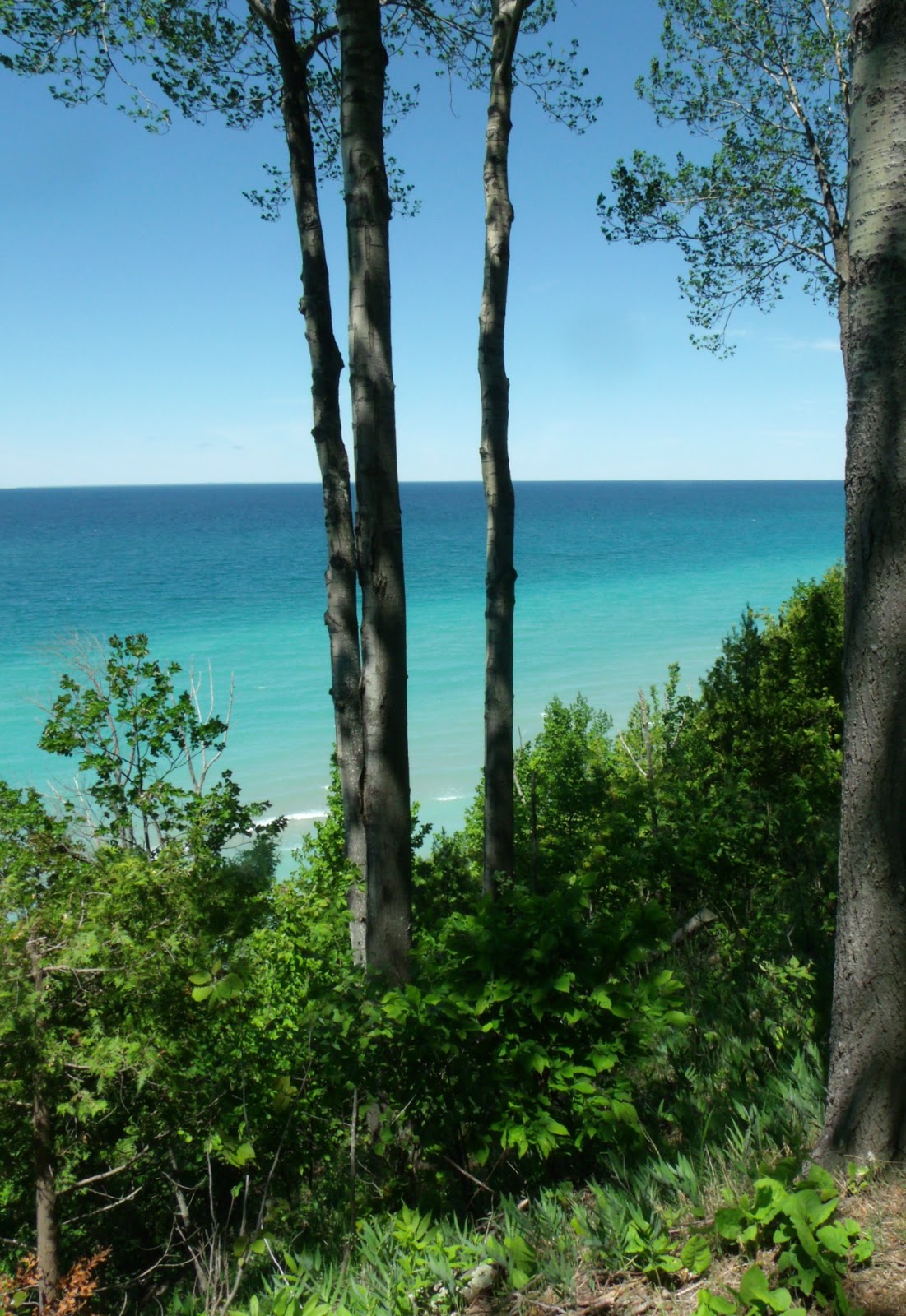
At the height of the bluffs, where the boundary between road and water is thin, the trees break to reveal stunning water vistas. You see a glimpse of such in the collage above. While this area is lined with residential homes and it is considered rude to stop and spend a day in someone's private park. There should be little harm in standing on the shoulder for photos. From this section one could imagine oneself in Greece or on some tropical isle. Lake Michigan stretches far out to the sapphire horizon, reinforcing its inland sea image. From this vantage point it is difficult to guess the terrain of the cliff face or how deep the beach at the bottom might be. There may be no beach at all.

It is somewhere along this passage that my housemate supposed actor Viggo Mortenson spent a Summer taking pictures and restoring an old cottage. She has lots of sidebar information in her head about stuff like that. And this was a really good trip for having conversations about nothing that were also not about crappy somethings and sad somethings that we can not change. Even in a car the natural beauty of our countryside and distant wilds has a calming effect. The mind wanders around the things we are curious about and not so much the things that we worry about. It could be the deep and lush greens of the canopy and the ground vegetation or it could be the vibrant jeweled blues of the water that calms. Which ever it is, whatever the combination of influences is, we need it. Nature heals the senses which I believe can calm a weary mind. Even in a car, whizzing along at 40 miles an hour.

After Horseshoe Bend we plunge into darkness again. The canopy becomes dense with some of the deepest shades of green imaginable. The temperature is a little cooler here too. On the day we were here, there were enough differing shades of green to make an Irishman smile. Almost no traffic that day either so having the road mostly to ourselves we didn't worry about getting pushed by tailgaters or squished by oncoming traffic.

Fewer homes sit in the dense forest. Fewer mailboxes mar pictures. And the conversation flows along meandering tangents until animals cross our paths. While it was the wrong time of day to see deer, there were a good many birds playing chicken with the car. The dappled light is soothing enough to make for some sleepy backseat passengers.

The road continues on like this until you get to the sleepy little town of Good Hart, the half way point on this long and winding road. Good Hart is a small place consisting of a General Store and Post Office maintained in picture postcard perfection. It is a great place for a potty break and to grab a bite to eat if you haven't packed a lunch like we did. The General Store stocks it's own specialty foods on the shelf as well as the expected standbys and has a deli. While we did not partake of the deli offerings, the homemade cookies near the register made mouths water. We were back on the trail once we refreshed ourselves.

The stretch between Good Hart and Cross Village begins to diversify with some sandy dunes breaking into the forest. The road becomes much more difficult to traverse as potholes and crumbling shoulders make for interesting conditions. M119 does not have a center yellow line down its middle as other state roads do and the fog line, the white line on the side, is worn. There is very little reason to travel this road at night and I wouldn't suggest trying. Even though it is a perfect Dark Sky site, the canopy is so thick over much of the road that you wouldn't really be able to see stars. This stretch also reminds me of the Pierce Stocking Drive in the Sleeping Bear Dunes National Forest on Leelanau Peninsula. The coast bluffs and the winds that rise from it probably have a lot to do with that as it makes difficult living conditions for all but the most hardy of species.

Cross Village bursts out of nowhere. The topography and vegetation give little warning that you are about to come to a village. You are in the trees and then you are in the village. Cross Village is much larger than Good Hart, It boasts a couple of successful restaurants, church, a couple of retailers and a public park. It is here in the public park that I found one of my bears. One side of the bear is a map of the Heritage Trail area and the other depicts Native American life along the lake shore here.

Sometime we will go again to sample the food here. People drive hundreds of miles to eat at the Legs Inn and I would like to taste what I am missing.

The Tunnel of Trees ends here in Cross Village. You have the option of going east to join US 31 and get back to civilization or continuing north. We opted for the northern route, erroneously thinking that we might get to the bridge along the entire tip of the mit*.Somewhere north of Cross Village the Wilderness State Park's 10,000+ acres is in the way. You have to veer east to the tiny one building town of Bliss to continue northward. Along the way there is more rolling farm land, some wetlands, a few more dunes, and some picturesque farms. Emmet county has very little flat surface to it. The whole thing is like a rollercoaster. No wonder my cousins enjoyed it so much.

We did get a bit turned around and were helped by a friendly FedEx driver. But once we were on our way it was smooth going into Mackinaw City.


*Tip of the Mit is the local vernacular for the region of Northern Lower Michigan encompassing Antrim, Otsego, Monmorency, Alpena, Emmet, Cheboygan and Presque Isle counties. They are the northern most counties of northern lower Michigan which is notable for its mitten shape.

Saturday, June 11, 2016

Destination: Mighty Mac

Summer in Northern Michigan means road trips. Be it a day long excursion or a multi-day adventure, the folks here have to get out and see our beautiful countryside after a long discontented Winter. While Winter 2016 was mild in terms of cold and precipitation, it was still brutal in terms of the lack of energy giving sunlight. And some times, you just have to get out of Dodge.

Resort towns dot the landscape of Northern Michigan. The months between Memorial Day and Labor Day provide a good chunk of yearly income to the mom & pop stores here. Without Summer some places would fold up for good. Traverse City keeps ranking high on travel lists, creating a larger tourist base and a greater need for locals to get out of the quintessential city of discontent. *

While not everyone can afford the kinds of vacations our listings encourage, the kind our economy thrives on, there is one way to enjoy the surrounding area of this, and any other hometown without going broke...

The Old Fashioned Way.

Clean out the car of the Winter debris, give it a good vacuum, pack some essentials then load up the gang and head out on the highway. When we were kids the Coleman cooler in electric teal blue filled the trunk almost entirely and was packed with all the essentials for a family of five for the day: Water, Faygo, lunchmeat, condiments, bread, onions, cheese, tomato, fresh cubed melon or fruit salad, potato salad, bean salad and chips, complete with a small cutting board and a sharp paring knife. Mom also packed paperplates, plastic silverware, cups and paper towels.The cooler was surrounded by beach blankets and towels, extra pants or shirts, sand toys when we were very little, and jackets in case of rain while the backseat held our distractions. For me it was a copious amount of reading or art material.

Little has changed in my 40 years. May and June are perfect travel months in Northern Michigan. Sure the weather is wholly unpredictable and requires an Eagle Scout level of preparedness but those months won't sizzle your brain like July and August do even with air conditioning. So this week, unpredictability in the forecast, the household packed up the car with lunches and drinks in a soft insulated bag, spare batteries for cameras, copious amounts of art supplies for the teenager and books for me. Then we aimed for the Mighty Mac and meandered on an undecided path to get there.

We knew we needed to hit a certain beach to look for rocks, that we wanted to travel M119 and eventually get over the bridge for some of the best smoked fish ever. Everything else was up to Fate of Wit & Whimsy. Getting out of town is always an adventure in and of itself as there is road construction just about every where you look. So after a rousing 10 minute round of Todd Yohn's Orange Barrels, we were finally reached escape velocity and were off.

The morning started out cold and windy, frost advisories should have been given the two nights before we left. My smarter gardening friends covered their plants any way. It was in the low 50s when we left. In spite of the cloud cover the day was bright and cheery between cloudy conditions.

First Stop: East Port.
East Port sits at the north end of Antrim County and directly across US 31 from the northern tip of Torch Lake, 32 miles from our start, Traverse City. That 32 miles is dotted with farms, some of which still function, multiple farmers markets and farm stands and most notably the city of Elk Rapids and the town of Torch Lake. There are also a few towns that consist of a single store, a school and are "If you blink, you'll miss it" size. East Port is such a small town. It's major landmark is the Barnes County Park where our first adventure takes place.

We are a simple people and find pleasure in the quiet pursuits. My housemate is a rock hound, I am a photobug and the teenager is interested in viewing up close and personal those things which will improve her art. Barnes Park has a reputation for quietude and a cache of interesting things washed upon the shore by Lake Michigan's churning tides. The shoreline here is still within the boundary of the Leelanau Peninsula which lies across Lake Michigan's East Grand Traverse Bay from East Port. Judging from the wave action in the cove here, that protection is negligible in the face of strong westerly winds. Northport Bay is directly across the bay from East Port at the thinnest most northern point of the peninsula. Living in Traverse City and it's immediate environs, one is quite used the the water having a boundary. Here, in Barnes Park, one starts to feel the vastness of the water. The realization that Lake Michigan more than deserves it's description of an inland Sea settles in.

top left, examining rocks and oblivious to the low flying squadron upon them; top middle, resort HQ; end, shorebirds in a rough surf. Center, the small cove at Barnes Park beach. Lower left, the walkway down the beach; lower right, bits of little significance tossed up on the sand.


I spent our short time there with my camera in an attempt to catch birds in flight. Barring the elusive photo capture, I was willing to settle for one of the birds being smacked hard by the waves. Seagulls must be inherent surfers as none met a watery end. One of the other delights of this beach, at least for this year, is the quality of the shoreline itself. There were no bugs; the winds was so strong that they may not have been possible anyway. Without bugs, I was able to spend a good amount of time looking at the coastline. With higher water levels, there seemed to be two coastlines.

The obvious coastline is where the water and shore meet in the surf. But just inside of that line another formed. You can almost see it in the end picture above.  This photo on the right is more evident. There is a slight indentation which allows the water to collect and not completely recede when the waves ebb. The last few years water levels have been so low that where coves are protected the slope up the beach is even and none of these very shallow pools have a chance to form. In coves with tremendous wave action the water carves banks for steep drops that have eliminated much beach. Gouged beaches are not terribly interesting. There isn't anywhere safe for wildlife to stand and there is no good footing for wading. Gouged beaches are also very rocky and not fun for a long term sit. The smooth beaches are equally uninteresting in their flatness and the predictability of the wave action.

Just look at this beach though. It has been cut into terraces over time, gentle terraces. The line of dune grass in the foreground marks the edge of the first terrace and the gentle slope down to the surf makes for interesting things in the space-time between ebb and flow. I think it also gives the waves a more photogenic foam.

I've always been partial to sea themed art, especially watercolor. And this is the beach that is emblematic of the type of coastal art that I find most soothing and interesting to look at. While art and photography are wonderful things for preserving a moment, nothing really beats the live action of being there. I'm a water baby and have always been drawn to the constant motion of the shore more than the placid surface of an inland lake. I could watch water all day long if it is moving. Light dances, the wind draws you in as a participant rather than leaving you as a casual observer on land. While I can not do the complicated math involved in measuring wave action I do love dynamics of motion.

It was too cold to be in the water searching for Lake Michigan's geologic treasures or to enjoy the crystalline waters as a swimmer but it was a perfect day to watch the water and the waterbirds who seemed to be showing off their flying skills. With my merry band of travelers, it was also the perfect day to pull out the puns: George, Katie and Steven Seagull playing in the water.

You & Shakespeare want to kill me now. Imagine how badly my housemates want to kill me nearly everday!


*That would be the aforementioned Dodge


Friday, June 10, 2016

Day Tripping

l. cross village, top central lake, r. elk rapids
bottom l charlevoix, bottom r elk rapids

A couple of years ago the then BF and I spent a lot of time taking day trips around Northern Michigan. While we were trekking about in Elk Rapids we came across the first painted figures. While the housemates and I were tripping up to the Bridge, we found another one in the little town of Cross Village. He is housed in a gazebo in a roadside park.

The plaque next to the gazebo explains where these gems came from and why. The bears are from a 2005 fund raiser for the American Red Cross. According the article in the link there are 45 of these things out here somewhere. I have found three. The fish are from a 2003 fundraiser. I am not sure how I did not know about these things as they were happening. Now that I have found these few, it is a thrill to find more.

Sunday, May 8, 2016

You Can Always Go Downtown

Recovering from this heart issue is taking longer than I like. And I am getting a bit anxious about how it is all going to work itself out. In the mean time I am taking the opportunity to get back in touch with the activities that really have helped me to grow in the last decade. One of those things is the area I grew up in. There are many beautiful vistas and some quiet spots for contemplation. This week everything came into blossom so I will be out with friends who drive to get some of the quintessential and iconic photos of the area. And I need to go back and figure out why my panoramas didn't work today.

The next few days will be busy for me. To tide you over, here are some random photos from my therapeutic walk downtown.


This is one of three bridges that cross the Boardman River in Downtown Traverse City. The very last building in the background on the right is the courthouse. The Park Place Hotel is obscured  by trees in the midground. And fortunately, there were no cars during the busy lunch rush crossing the bridge.

The Central United Methodist Church's dome rises above the Boardman River. From this  vantage is seems to be the tallest building in down town. It is soon to be dwarfed by taller structures as the City Commission is struggling on building up rather than building out.

The top of the Park Place Hotel is a distinguished landmark rising above the treeline in Traverse City. It too will soon be dwarfed by larger buildings. Whereas the Park Place and the clock towers of the Michigan State Bank building and the Grand Traverse Courthouse were the most prominent features of the Traverse City skyline, they will be replaced. Several buildings already compete for attention above the verdant Summer and the autumnal tapestry of landscapes.

The clock tower of the former Michigan State Bank still shines from the corner of Front and Union. It has changed hands over the decades an still has remained a bank.
As kids, from any place we were in town. we knew that we were close to home, or at the very least how to get there, because this copper beacon served as a way finder. Between this tower and the steeple of the old St. Francis Church at Cass and 10th, we could always be certain of where we were.

One of the best things about Traverse City is the topography, landmarks abound and a talented parent can teach any child how to find their own way home.


I hope that you are all getting out and enjoying the Spring and Summer that we are being given. Explore your town with fresh eyes or look for the things that always bring you comfort. Seer them into you minds because everything changes. I photograph them because no one believes me when I describe the changes. At least here we have some proof.

Thursday, April 21, 2016

Back to Suttons Bay

My housemate took me out for a drive. I am not supposed to do a lot of that until I know how my meds will affect me. So she drove. We went downtown for a few quick stops. And then we went out to Suttons Bay. I haven't been there since breaking up with the BF and it was time. Mostly we just walked around. But I did find two places that I wouldn't mind making return visits to.

This is the Bayside Gallery. One of the tourism guides featured the stained glass yard ornaments on it's cover which inspired the trip out there. This time they were open as we went midday so we got to see everything.

A gently babbling brook runs the length of the property along the side street, featuring koi and a host of edging stones. It is quite beautiful and relaxing as well. The entire selection of goods is an eye-popping feast of colors and textures. Czech gazing balls, Chihuly styled spun glass, metal sculptures and resin cast figures abound. The staff was quite nice if somewhat frazzled in the gear up toward the Fudgie Season. All in all I would love to go back.


Actually, I would love to have the money to plant a garden of glass flowers in some part of the yard. Talk about low maintenance! They are gorgeous. While some of my herbs are coming back. None of my flowers are. I think I have proven that this is the only way for me to get gorgeous blooms.

Tucked into the back end of a piece of property that forms a bit of a courtyard, Case and Daniels is a nice little shop for sculpture, jewelery and woolen goods. The man behind the counter is the man responsible for the large mobile in the atrium of the Traverse City Public Library.

Suttons Bay, and this courtyard in particular, illustrates what I like best about small town living and small town atmosphere. Character. Character is a subjective quality that differs between individuals but which general shares the common trait of being unexpected. In Traverse City there is coming a kind of uniformity that makes the Victorian Era character of the original downtown homogenus. In the name of streamlining and progress, eliminating visual clutter and being able to fit more business into the limited spaces, Traverse City is starting to lose the kind of charming character that Suttons Bay and its sister city in Antrim county, Elk Rapids, retain. And that is the ability to tuck unexpected treats into corners. Elk Rapids planted small gardens in unusual spots where nothing else could be done. Suttons Bay has rainwater run of gardens. Both villages have tiny places like this left to surprise and delight. Of course the smaller size and the smaller crowds make it ideal for leisurely shopping. But they also allow you to take your time and savor the experiences.

Tuesday, April 19, 2016

Moon Over Michigan

Part of our drive took us out Leelanau Peninsula to Christmas Cove. It was a good day to be at the beach. It wasn't warm and I didn't go down to the water. Just in case there was an episode I felt I should stay by the car and not be where my housemate would have to fireman carry this sack of potatoes up a steep embankment. I stayed up top and sat in the sun.

And took pictures


Saturday, November 28, 2015

Memory Stones


Sometimes when we are bored and seeking a small adventure my best friend, or her daughter, and I will go to a cemetery and look around for interesting bits of sculpture, inscriptions, spirits and whatnot. It is normally in the fall that the Oak Park Cemetery is most vibrant and beautiful. In Summer the canopy is so thick and green that getting good shots with my amateur camera is almost impossible. Not only that, the bright fake flowers adorning the grave sites is always unnerving for me. Nothing screams insincerity like fake flowers. But rules are rules and most cemeteries these days don't let you plant real flowers.  So there is that. I've always liked Oak Park because of the variety of sculpture, mostly Victorian Era. Oak Park is also home to most of the Founding Fathers of Traverse City and was always the "Catholic Cemetery".

I grew up Catholic and went to a lot of funerals with my dad, though not very often to attend a graveside service. Death and I are not strangers, but we aren't buds either. Death is just another thing; like too many relatives in the house at Christmas, and ignored birthdays.  It comes at the end of Life, requires a shindig, public lamenting and then...

The "And then" always bothers me. And then often is a few years of dedicated visitation that tapers off as grief gives way to a life resumed. Following the lack of visitation there is, for some, a period of guilt that is oft overcome with the thought that "Well, he's dead. What does he care if I don't go?" The "And then" for the dead is a physical decay. But how many of those dead stay with the body, limited in spirit to the confines of the cemetery? And for how long?

I can not imagine a fate worse than to be trapped with a useless body and watching parade after parade of histrionics when grief is most poignantly felt then great swaths of time when no one comes to visit anymore. Then, when the traffic slows to the slightest tickle the gawkers and ghost hunters arrive to coax ghoulish cries. Of course, on occasion, one can watch the malicious destruction of property as grave stones are smashed by normally idle hands. I don't know what is worse. The immediate shock and grief or the "and then"... being ignored.

As one of the troupe of curiosity seekers, hoping to encounter and not encounter entities in the cemetery, drooling over the artistry in the markers, marveling at the age of my city and lost in the solitude the quietness of a cemetery in daylight engenders, I try to keep the murmur to a dull roar. I can neither see nor hear the dead. It is rare that I can feel the presence of those who have passed and got stuck here. And, I try not to disturb a site that is clearly visited by family and friends. I will right a potted plant that has toppled and been ignored by the grounds keeping staff. And I avoid freshly turned soil, giving it a wider berth than is likely necessary. Sometimes though, I can not help but get up close and personal.

Normally, I do not delve deep into this cemetery. Most of the truly interesting sculptural pieces are near the front on the 8th street side. I'd been told it is the oldest part of the cemetery. I had also been told it was the "Catholic" cemetery. So this time, with the younger friend, we went deeper. Much to my surprise, I found a Jewish section. Traverse City has always had a very small Jewish population. At one point large enough for it's own temple but which has waned in recent decades. The Jewish synagogue is now part of the courthouse complex. There are still Jewish families in town, worshiping alongside other faiths, and tending the graves of family members.

Most of the stones in the Hebrew section were covered in any number of small pebbly stones such as the picture above. It is uniquely Jewish. A good explanation is here. Depending on the traditions one grew up with it is either to keep golems at bay, to bind the soul to the earth or to mark a connection between visitor and the visited.  My gut tells me that this is a marker to mean, "I thought of you". Flowers die, stones are more permanent. And it seems like one of those long term things that Jewish a good at when it comes to zakor , which means "remember". Leaving the stone is like leaving a bit of yourself to stay with the decedent.  Somehow, being there helped me feel a bit better about Shayne, even though he is buried in Chicago. It also made me miss him so much more as we come upon the anniversary of his passing, and leaving the marker of his birthday last month.


Tuesday, July 28, 2015

What did you do on your Summer Vacation?


My sister was home for the first time in 10 years. She and her family stayed in a cabin on a local lake and planned a week of high adventure. The oldest kid is 11 going on 12 and the youngest is barely two years old. I, being newly interned in my position, had one day to join them. I chose the Dune Climb.

The Dune Climb is the main attraction of the Sleeping Bear Dunes National Lakeshore, a National Forestry Service park that stretches many miles along the Lake Michigan Coast on the Leelanau Peninsula and encompasses both North and South Manitou Islands. The stretch of water between the islands and the peninsula is known as the Manitou Passage and sports several shipwrecks which periodically have bits lurched to shore by the Winter's ice floes. This Winter with the reappearance of ice caves was especially bountiful for beach wrecked bits of ships.

To get to the passage from the parking lot you simply climb this dune. It looks like a sand pit for a quarry doesn't it? Just a big sand hill, no problem. Right?

Wrong. The degree of slope on this thing is deceptively steep. Even the well muscled have trouble getting up here. But if you think that there is water on the other side of this hill... think again. Another smaller hill rests in a bowl behind this then continues, as the sign says, for "Another 1.3 hilly miles" before you get to water.

My sister and her crew were quite obviously the first up the hill. I had the camera and wanted to get this shot.

These are the Glen Lakes with the narrows cutting across them. If you wonder why anyone would climb this pile of sand, this view is one of the reasons.

The other reason is the stunning view once you get to the top of the second dune. I would love to tell you that we made it to the water. But I did not. And my camera didn't even make it to the top of the second dune. Apparently my rechargeable batteries don't hold the same charge that they did two years ago. So you will have to go here for the virtual tour. I was so mad.

Once my little cousin and I got up the hill,our fair skin got the best of us and we sat in the shade for close to two hours. Our one bit of shade was inside the bowl of a shallow canyon of sand. It would have been a perfect place to play with the fish eye lens. It was gorgeous and close. I could have played with the panorama setting as well. But we had a good chat about life and everything. Then as things go, our paranoia got the best of us. We hiked up the second dune rise.

And from there we saw the face of the Manitou cliff that everyone sees in stylized representations of the dune area, But that is all we saw. Even though we left early enough to get there before the sand was Lawrence of Arabia hot going up, we weren't that smart or lucky on the way down. We sought shelter again, pulled out the art supplies in my pack and waited for the entourage to return from the sea. It wasn't a long wait.

The trek back down the slopes were horrific. We almost lost one cousin to heat stroke but she muddled through and had my brother drive her car. We almost lost me to heat stroke but I was in the shade most of the time. Once we got to base camp and water life was so much better. We did the Pierce Stocking Drive. Fortunately I have photos from last year's day tripwith last year's boyfriend. Unfortunately these are not the best photos you will ever get of the area. Last year was hazy because of the drastic contrast of air and water temps. This year... the camera had no juice. This is just how stunning the views are.


From the overlook you can both islands on a clear day. On a day like this,not so much. Even this close up panorama didn't do any justice at all to the majesty of the view. On a clear day you can see how the legend was born. On a hot July day like the one we ventured up the dune on it is hard to see what possessed anyone to climb this thing as see the resemblance to the story. Honestly, I wondered for the millionth time what possesses anyone to climb the dunes,,, even for the spectacular view. I suppose it is the age old answer...

Because it is there.

that deep green shadow in the mid ground is where the lake is. Since our youth
it has become green with plant life since the National Park Service forbids
"restoring" the beaches for recreational use. They hope it will revert to its
natural wild condition. In the mean time... swim if you like. 
From another overlook further along the drive you can see one of the Bar Lakes. Two kettle lakes were formed as the glaciers that deposited the dunes receded. I don't know if I believe that this lake, North Bar, has not been completely measured because it is so deep. But I do believe there are big ass fish here.

When we were in high school and community college age, my friends and I would come out here and make the trek in from the unpaved parking lot to the lake to perch atop a dune between the kettle and the big lake. We would play on the Michigan shore, traverse the dune for a splash in water warmer than a bath and then dowse oursleves in the cold waters of lake Michigan. It is a Trolls Shake and Bake Sauna. Yooper's will know what I mean. In this picture you can see the Empire Bluffs in the background. The village of Empire lies on the other side of that point along with the smaller kettle, South Bar Lake. South Bar is completely cut off from Lake Michigan.

Here is the best shot I could manage of North Bar's inlet to Lake Michigan. The greened over dune just to its right is where we had bonfires and I was introduced to the life long love that is a Dr.Pepper obsession. Thank you D. Scaer!

The best way to describe a kettle lake is to have you envision the edge of a kettle. It has a thin lip, a slight slope then goes straight down and into the belly of the pot. And, when you take a running leap off of the dune that is about the experience you have. Needless to say I would have bee a dish known as chicken a la king. I'd heard enough stories about man eating trout that I wasn't about to just "jump in with both feet". And I sure as hell wasn't going to be the first sucker in line. Living in a region ripe with legend and lore, I also didn't want to be the first person to discover our own Champy or Nessy. Especially since, in the belly of the beast, I'd get no credit for the discovery.

When we were kids there was definitely a lot more to see on this drive. It is growing well, erosion seems to be under control and the land is returning to its natural state. Though, I dare point out here that the Indian population indigenous to the region had been tramping through here and wearing down the dune grass since before the white man came and skunked them on trades. The dune buggies that tore the place up in the 40s and 50s were a bit much but there is really only so much a few hundred kids in the summer can do.

If you would like to get to North Bar to see this geologic treat yourself you can take the main road out of Empire up a county road instead of taking 22 to 109. Or, if you are on Pierce Stocking and don't mind a two track, you can take Schauger Hill road. If you do be warned, it is dangerous at high speeds. It;s like driving through Jurassic Park, If it rains a little there are deep wash outs. More than one axel has been severed on this road. But if you have a sense of adventure and a cheap car that will meet ORV standards by all means enjoy Schauger Hill safely. It is my preferred entrance into North Bar's rec area.

Mostly Pierce Stocking Drive is a botanical feast of soft and hard woods, and conifers that make you wonder how any thing can grow out here to any great height. The winds off the Dunes are brutal. M-109 can be closed for days due to drifts of either snow or sand. When the rest of Leelanau County is clear in Winter the passage between the Dune Climb and Glen lake can be dangerous with gusting winds that will move your car off the road if you aren't paying attention. In the 8 years of my paper route out here there was not a Winter day in which both hands were not on the wheel. And very often my stomach was up in my throat.

You have to be  tough to survive these conditions. And no where is that more evident than in the gnarled and exposed roots of the Cottonwood grove. This is what it looks like to hold on for dear life.

Once we left Pierce Stocking we headed into the Village of Empire. South Bar lake for all the sun drenched, ready to pass out people in the car. The water was nice and full of people. The sun was still hot. It was a short cool off before heading back into Traverse City for a scoop of Moomer;s Ice Cream. Tell you what, that mint felt good on my insides. Even having sat in the shade and wearing sunscreen, and taking an umbrella (yes I did.) I was about done in when we got to my sister's place.

Quick nap. Dinner of brats and another nap while the kids colored or slept & I wandered home.

To come down with Strep two days later.

Sister met me at the Doctor to say good bye. She thinks she broke me. Honestly, with the hours I have been putting in it was a matter of time before something felled me. And here we are on Tuesday, 3 days since she headed for home, and I am still sick. Doc says strep. My throat says things that I can not repeat in any language which essentially amounts to "I hate you."

It was good to do this with new people. I mean my sister and I have done this a few times, for school, with neighborhood kids and then with our friends in high school. I went last year with the boyfriend. And everything is different when you do it with kids. It's always fun for them. Sometimes not so much when they realize how big this adventure is going to be. But the coming down always makes up for it. I met a new cousin. Hung out with a cousin I knew. And even if I couldn't make it to the shore and my camera died 6 pictures in  it was still a good time.

I only wish that I could call this a Summer vacation instead of Summer Sick leave. Vacations are always much more fun and, for me, involve far less vomit.